Bahia Honda State Park, Florida: Choose Your Beach and Visit Plan
Plan a Bahia Honda State Park day in the Florida Keys by choosing an actual beach area, checking current park alerts and separating day use from camping or a booked activity. This independent visitor guide was reviewed on October 18, 2026. It offers an adaptable planning sequence, not a reservation or a report of today's conditions. Check the linked official source before travel and follow on-site closures and staff directions. A photograph or an inviting forecast cannot establish that ocean entry is appropriate.
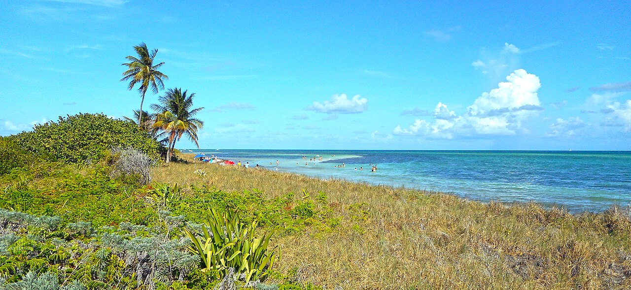
Photo: Daniel Di Palma · CC BY-SA 4.0. Reference photograph: Bahia Honda State Park - Beach with palm trees.jpg. It does not establish current access, weather, operations or a future event. Display may crop the original.

Use the exact state-park destination
Bahia Honda is a specific Florida Keys state park, not a generic tropical island stop. Save the official park page and intended arrival point before building the drive. Keep the destination consistent with your photographs and route. A bridge image may help identify the setting but does not establish access to every structure or beach area.
Choose an area from the current park map
The official amenities page describes multiple beaches. Compare their current access, facilities and intended activity rather than assuming the first place you see serves every need. Read park notices because storms or maintenance can affect areas differently. A map from a past visit should not override the current managed route.
Check day-use details directly
Use the official hours, fees and alert pages for the date and the categories applicable to your group. Keep parking and admission questions separate from an overnight reservation. Do not assume a campsite booking or another service automatically answers every day-use condition. This guide leaves future prices and availability to the current official source.
Make the drive part of the schedule
Identify the route from your actual accommodation and leave room for arrival and the walk to your chosen base. Treat other Keys stops as optional rather than creating a chain that requires perfect traffic and immediate parking. Keep food, rest and the return drive visible. A short distance on a vacation map can still create a tiring day.
Assess water activity independently
Read current park and coastal notices and follow warning signs or staff instructions. The color of the water and the reputation of the Keys are not a swimming assessment. If considering snorkeling or another activity, verify the operator, requirements and change terms separately. Admission and equipment do not guarantee suitability or provide personal supervision automatically.
Plan a modest shore-based alternative
A suitable beach walk, observation and a picnic can be the main visit when ocean conditions or personal comfort rule out water activity. Choose the permitted route and a turnaround that leaves time for return. Do not approach a closed bridge or damaged area for a photograph. The day should remain worthwhile without recreating one familiar online image.
Carry what the actual area requires
Check current restrooms, food and water arrangements and bring permitted necessities without assuming every service is operating. Keep the load manageable between parking and the beach. Limit valuables, control food packaging and prepare to take waste to appropriate disposal. If the group splits for a booked activity, ensure each subgroup has essential belongings and a meeting plan.
Follow the current departure instructions
Work backward from the park's current closing or reservation conditions and the drive home. Leave time to pack without rushing across the site. If an afternoon change affects the plan, shorten optional activities first. Account for every person and item before leaving rather than discovering missing belongings after beginning a long onward drive.
A worked plan you can adapt
A pair driving through the Keys makes Bahia Honda its main stop rather than one of several mandatory beach visits. They read the current park map and choose an area suited to a shore-based picnic and walk. A snorkeling option is evaluated separately and stays conditional on requirements and conditions. Their note distinguishes admission from a possible future camping booking, and the bridge photograph remains a visual reference rather than an instruction to access a structure. They leave enough time to pack and return before the drive becomes uncomfortable. This invented plan promises neither an open beach area nor equipment, parking or clear water on a future day; it keeps the decisions connected to current official information.
Your working checklist
Checkmarks stay in this browser when storage is available. They do not submit information or complete a purchase.
Put it into practice
- Open the official Bahia Honda State Park information and confirm the exact destination and current alerts.
- Choose a beach area using the current map and its actual access and facilities rather than treating the whole park as one uniform beach.
- Check current day-use arrangements separately from camping, equipment rental or another reservation.
- Plan the full drive, final walk and return, keeping extra Keys stops optional.
- Review current coastal conditions and verify any separate operator's requirements before considering water activity.
- Use a permitted shore-based alternative if conditions, closures or personal needs make the original activity unsuitable.
- Pack the complete setup and follow current departure instructions with enough time and energy for the return.
Before you finish
- The access point for Bahia Honda State Park agrees with the saved map and your transport destination.
- Access, current alerts, local rules and any required reservation have been rechecked.
- The day's activity fits current conditions and the group's needs, with no promise of safe swimming.
- Everyone knows the return plan and all belongings and waste have been accounted for.
Common questions
Are all beaches in the park interchangeable?
No. Compare the current map, access, facilities and notices for the actual area you intend to use.
Does a camping reservation answer every day-use question?
Do not assume so. Read the reservation and current park instructions separately, including arrival and access conditions.
Can I approach the old bridge wherever I want for a photograph?
Use only the current permitted routes and follow closures. A recognizable image is not permission to enter a structure or damaged area.
Is snorkeling guaranteed by a park visit?
No. Current conditions, ability and any operator's requirements matter. Admission or equipment alone does not provide a suitable or supervised activity.